


Description
Compact in size, yet big on features and performance, the FURUNO GP-33 is the perfect GPS navigator for a wide range of vessels. This advanced unit provides accurate and reliable position fixing, thanks to a super sensitive, 12-channel GPS receiver combined with integrated SBAS (WAAS/EGNOS/MSAS) technology.
- 4.3" "Sunlight Viewable" color LCD (Brightness: 700 cd)
- Enhanced data legibility thanks to large characters and high resolution visual aid
- Stores up to 10,000 marks/waypoints, 100 routes and 3,000 track points
- 7 display modes available, including 2 user-customized modes
- Supports both NMEA0183 and CAN bus interface
- Contact closure capability available on the 10P connector
- SBAS capable for better measurement
A smart navigation solution that fits perfect into the console
Easy Operation
Innovative digital graphic displays and intuitive on-screen menu structure provide simple operation and easy access to the features used most frequently.
What is CAN bus?
CAN bus is a communication protocol that shares multiple data and signals through a single backbone cable. Simply connect any CAN bus devices onto the backbone cable to expand the onboard network. With CAN bus, IDs are assigned to all the devices, and the status of each sensor in the network can be detected. All the CAN bus devices can be incorporated into the
Various Displays
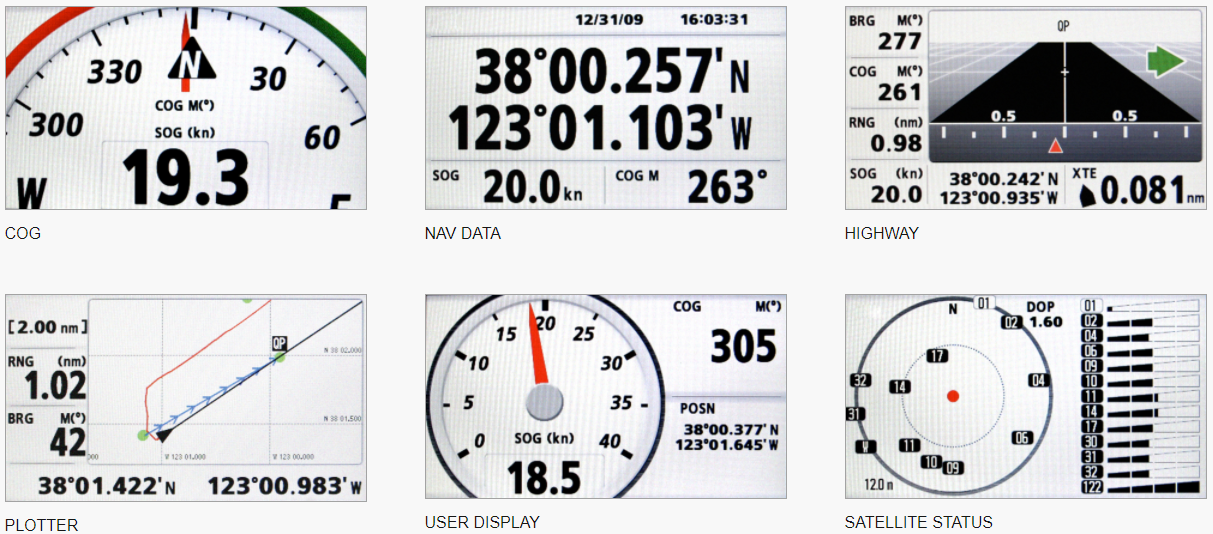
The GP-33 provides navigation data and displays them in a wide variety of numerical and graphical formats. Freely select which data is displayed with easy to use controls. The combination of a high resolution screen and large data fields makes the screen easy to read in almost any condition.
NAV data - The nav data display shows receiver status, position in latitude and longitude (or TDs), course over ground, speed over ground, date and time.
Highway - 3-D view of own ship’s progress toward destination (waypoint). This mode is best used for navigation when a straight line course can be followed.
COG - Easy to read digital compass heading display that greatly assists in maintaining a desired course.
Plotter - shows position on a 2-D map*. This mode presents various data and information with graphic symbols and icons, rather than text. The Auto Waypoint Entry function plots ship’s track as “WAYPOINTS”. The user may define waypoint entry by time interval, tack angle, etc. (*The unit does not include charts.)
User Display - Choose what data is displayed in the User Display Mode.
Payment & Security
Your payment information is processed securely. We do not store credit card details nor have access to your credit card information.